
Leading The Way in Drone-Based Building Surveys Across Cheshire
Accurate survey data and high-resolution imagery from advanced drone and ground-based technology.
Drone Survey Services Cheshire
Precision Surveys. High Standards. Advanced Technology.
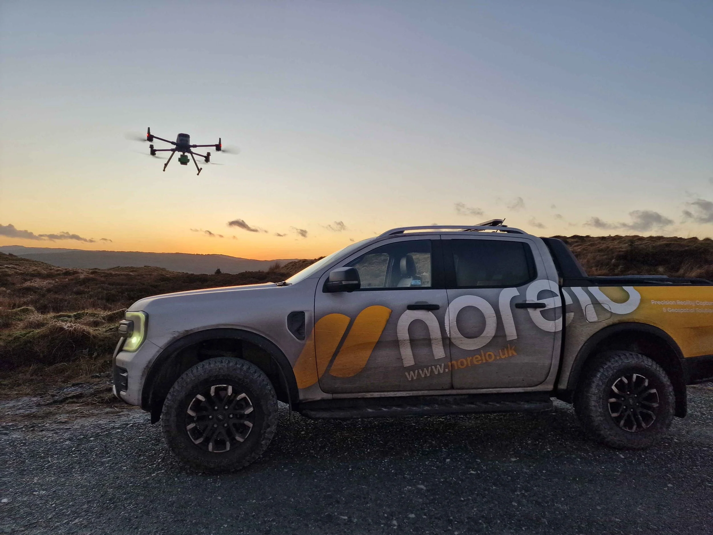
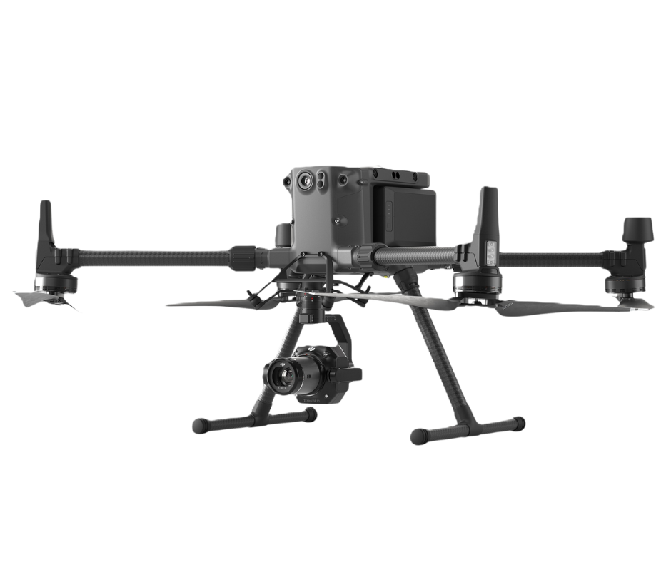
Norelo provide high-precision drone surveys across Scotland, England, Wales, Northern Ireland, and the Republic of Ireland, covering everything from city centres to remote industrial sites. Norelo’s CAA-approved pilots operate under full Civil Aviation Authority (CAA) Operational Authorisation, ensuring safe, compliant, and efficient aerial operations. Using DJI Enterprise drones with high-resolution cameras, LiDAR sensors, and AI capabilities, Norelo capture detailed data for roofs, façades, chimneys, bridges, and other hard-to-access structures without the need for scaffolding or costly access equipment.
Through aerial photogrammetry, orthophoto mapping, and visual condition surveys, Norelo deliver clear, actionable results for property managers, engineers, and construction professionals. Norelo’s services provide defect imagery, 3D models, and comprehensive inspection reports, enabling faster decision-making and cost savings. From a roof inspection in Glasgow to a bridge underside survey in Dublin, Norelo’s drone surveys offer unmatched accuracy, speed, and safety.

Cheshire Drone Survey Deliverables
Norelo operate drone surveys with unrivalled technical accuracy and clarity. Using the DJI Enterprise range of drones, with photogrammetry, and LiDAR, Norelo produce detailed roof, building and asset surveys, trusted by architects, building surveyors, and commercial landlords across the UK and Ireland.

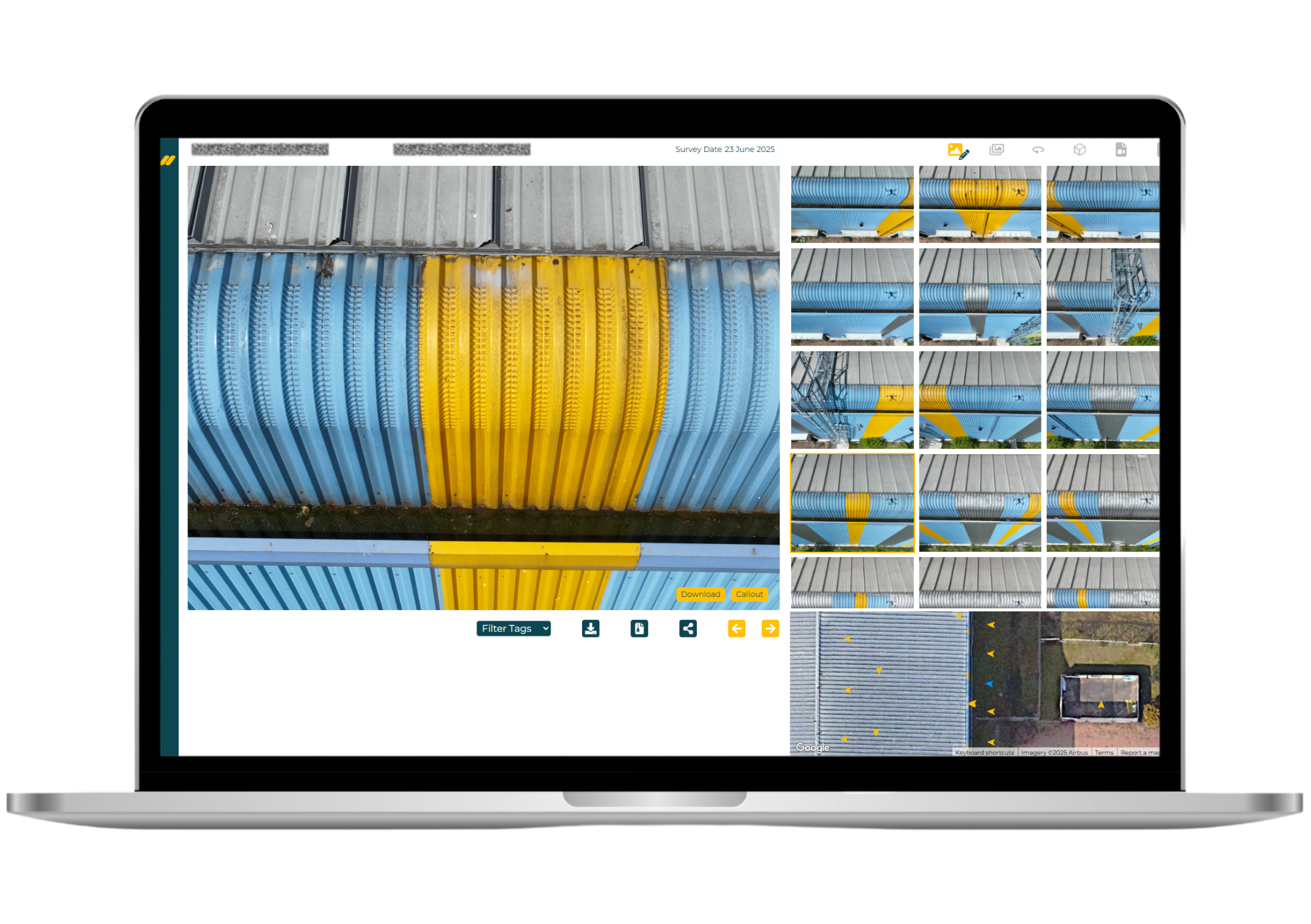
High-Resolution Imagery
Capture sharp, georeferenced images and orthomosaics for condition monitoring, site documentation, and visual analysis.
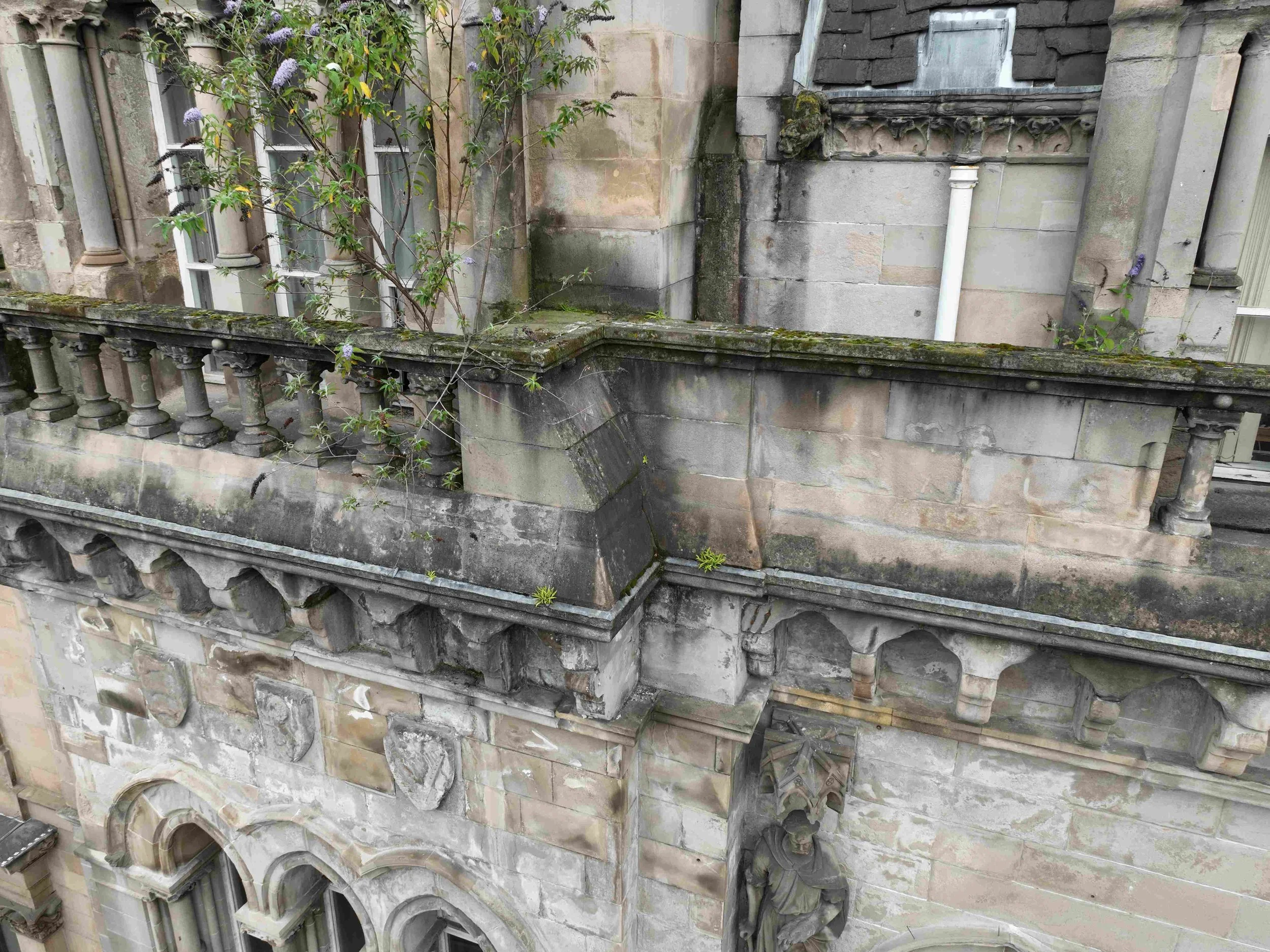
Façade Inspection
Detailed aerial inspection of building façades, including masonry, windows, cladding, and architectural detailing, without scaffolding or cherry pickers.
Roof Inspection
Analyse pitched and flat roof surfaces for defects, flashing issues, and structural movement, even in inaccessible areas.
Window & Glazing Inspection
Zoom-capable drone imagery enables condition assessment of glazing, seals, frames, and signs of leakage or condensation.
Roofline & Gutter Inspection
Inspect guttering, fascia boards, parapets, flashing, and rainwater goods from above to detect blockages, corrosion, or joint failures.


Mansafe System Inspection
Referencing personal protective safety systems installed on roofs, we capture aerial views to verify anchor points, walkways, and certification tags.
Bridge Deck & Underside Inspection
Access underside deck and structural surfaces using precision drone flight paths and hidden-angle capture, ideal for civil engineers and public infrastructure teams.
Corrosion & Rust Detection
High-resolution visual imaging reveals areas of metal corrosion or structural degradation, often undetectable at ground level.
Chimney, Stack & Flue Surveys
Close-up inspections of chimneys, flues, stacks, and ventilator systems for masonry damage, joint movement, paint failure, or bird ingress.
Why Choose Norelo?
Norelo combine industry-leading technology, expert survey knowledge, and a client-first delivery approach to provide accurate, reliable, and actionable survey data across every project.
Industry-Leading Technology
Norelo deploy the latest aerial and ground-based systems, including drone photogrammetry, LiDAR, total stations, and terrestrial scanning to capture detailed 2D and 3D data with precision and efficiency. That means faster surveys, richer datasets, and dependable results for planning, design, and construction.
Comprehensive Survey Capabilities
Whether you require drone surveys, measured building surveys, LiDAR scanning, topographical mapping, or photogrammetry, Norelo’s multi-disciplinary team delivers complete solutions tailored to your project requirements. Norelo integrate multiple data sources to ensure comprehensive coverage and thorough analysis.
Accuracy You Can Trust
Norelo’s surveys are conducted by experienced professionals using calibrated equipment and best-practice workflows, ensuring high-resolution outputs and geospatial accuracy for critical decision-making.
Efficient, Cost-Effective Delivery
By leveraging advanced survey platforms and streamlined workflows, Norelo reduce onsite time and maximise value, saving you time and cost without compromising quality or safety.
Flexible Integration With Your Team
Norelo work as an extension of your project team, collaborating closely with clients, engineers, architects, and planners to align deliverables with your standards, timelines, and outcomes.
Clear, Actionable Reporting
All surveys are delivered with detailed reports, annotated visualisations, and accessible data formats that support your next steps in design, planning, maintenance, or compliance.
Trusted by Professionals
Clients across construction, architectural, civil engineering, and infrastructure sectors rely on Norelo for insights that enhance planning confidence and reduce risk.

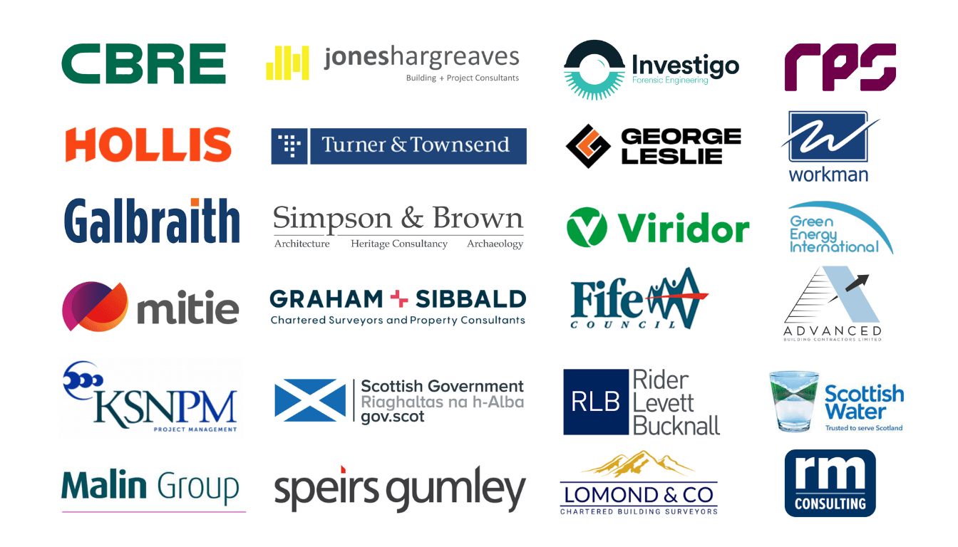
Orgonisations Norelo Partner With
An Extension of Your Team, Partner With Norelo
Norelo don’t just deliver survey data, Norelo become a trusted extension of your team. Norelo integrate with your workflow to understand your objectives, challenges, and deadlines so that project delivery feels seamless, efficient, and aligned with your goals.
Whether you require additional technical capacity for complex measured surveys, specialised drone operations, or precision geospatial modelling, we work with you to fill the gap, without the cost and delay of internal recruitment. Norelo’s experts augment your existing resources, giving you access to skilled specialists on demand while keeping full control of the project scope and quality.
What You Can Expect When You Partner With Norelo:
Collaborative Planning: Norelo begin by understanding your project requirements in detail, including schedule, deliverables, and outcomes.
Integrated Communication: Your team and Norelo coordinate at every stage, ensuring clarity and alignment with your workflows and standards.
Flexible Support: Scale Norelo’s involvement up or down as your project evolves, whether you require short-term expertise or long-term collaboration.
Transparent Process: Norelo provide honest timelines, clear reporting, and project milestones, keeping you informed every step of the way.
By working as an integrated partner, Norelo enhances your capacity without burdening your internal teams, giving you specialised survey delivery, dependable scheduling, and practical insights you can act on with confidence.
Contact us today to discuss how Norelo can support your next project.
START YOUR PROJECT
Email: Info@norelo.uk Call: 0141 353 9557
Norelo Ltd, is dedicated to delivering cutting-edge surveying solutions across the United Kingdom. Norelo’s team of seasoned professionals combines technical expertise with innovative technology to provide accurate, high-quality data, tailored to your project requirements.
WANT TO KNOW MORE?

Norelo proudly deliver drone surveys across the entire UK and Ireland, supporting clients from city centres to rural estates. Whether your project is in Glasgow, London, Dublin, Manchester, Belfast, Aberdeen, or anywhere in between, Norelo’s team of professionals deploys the latest in laser scanning, drone LiDAR, total stations, and photogrammetry to ensure consistent accuracy and quality across all locations.
Explore full list of service areas and local drone survey pages here
AREAS WE COVER
FAQ
Drone Survey Questions
-
A drone survey involves using Unmanned Aerial Vehicles (UAVs) equipped with high-resolution cameras and advanced sensors to capture data from above. These drones fly over the site, collecting imagery and measurements that are then processed into detailed 2D maps, 3D models, and reports.
At Norelo, the process is handled by experienced, CAA-approved pilots who combine technical expertise with top-tier equipment to ensure precision and safety every time. -
Drone surveys are remarkably accurate and often rival or exceed traditional ground-based methods, especially for large or complex sites. With tools like RTK GPS, LiDAR, and photogrammetry, drones can capture data to centimeter-level accuracy.
Norelo’s surveys are backed by rigorous QA processes, industry-grade equipment, and experienced surveyors, delivering exceptional accuracy without the time or access constraints of conventional methods. -
A wide range of projects benefit, including construction monitoring, land development, infrastructure inspection, environmental studies, heritage conservation, and energy audits.
Norelo’s versatility allows us to tailor each survey to the client's requirements, whether you need condition inspection of a roof or a full topographical survey for a new housing estate. -
Costs vary depending on the site size, location, data requirements, and complexity of deliverables. However, drone surveys tend to be significantly more cost-effective than traditional methods, especially when factoring in access, time, and safety.
Norelo offers transparent, bespoke pricing, ensuring excellent value by aligning their services precisely with project needs. A typical roof survey would cost in the region of £375+VAT -
Faster data collection
Reduced health & safety risks
Access to hard-to-reach or hazardous areas
High-resolution imagery and detailed 3D modelling
Minimal site disruption
Norelo maximizes these advantages, using the latest drone and data processing technology to deliver high-quality results, often within hours of flying.
-
Depending on the sensors used, data can include:
2D Orthomosaic maps
3D point clouds and mesh models
Contour and elevation data
Thermal imaging and heat loss patterns
Volume and area measurements
Norelo’s in-house team ensures this data is processed and delivered in formats that seamlessly integrate with CAD, Revit, GIS, or BIM workflows.
-
The flight time itself can range from 30 minutes to a few hours, depending on the area. Processing and reporting typically take 1–3 days.
Norelo is known for its efficiency, often delivering full results within 24 hours, without compromising on detail or quality. -
The Civil Aviation Authority (CAA) governs all commercial drone operations. Operators must be certified, follow strict guidelines, and often require permission for flights near sensitive areas or populated spaces.
Norelo holds full CAA approval and comprehensive insurance, and they handle all risk assessments and permissions for complete client peace of mind. -
Architecture & Construction
Civil Engineering
Real Estate & Property Management
Renewable Energy (e.g., solar and wind farms)
Infrastructure & Utilities
Environmental & Forestry
Public Sector and Emergency Services
Norelo’s client base spans them all, proving our flexibility and expertise across a broad spectrum of sectors.
-
CAA approval and appropriate insurance
Proven experience in your sector
High-quality equipment
Fast turnaround and strong communication
Solid client reviews and transparent pricing
Norelo checks all these boxes, and goes further, offering consultancy-driven service and technical excellence that stands out in a crowded market.