Norelo - Transparent & Competitive Survey Pricing
VAT Registered – All prices are + VAT (20%).
Pricing may vary depending on location, site layout, and project complexity.
Measured Building Surveys
Measured Floor Plans
External Elevation Plans
Internal Roof Elevations
Reflective Ceiling Plans
Detailed Roof Plans
Cross Sections
Heat Maps Plumb and Level
Area Calculations
Tolerance Calculations
From £500
Measured building surveys with Norelo typically cost between £1,250 and £5,000 on average, with a standard surveyor day rate of around £500.
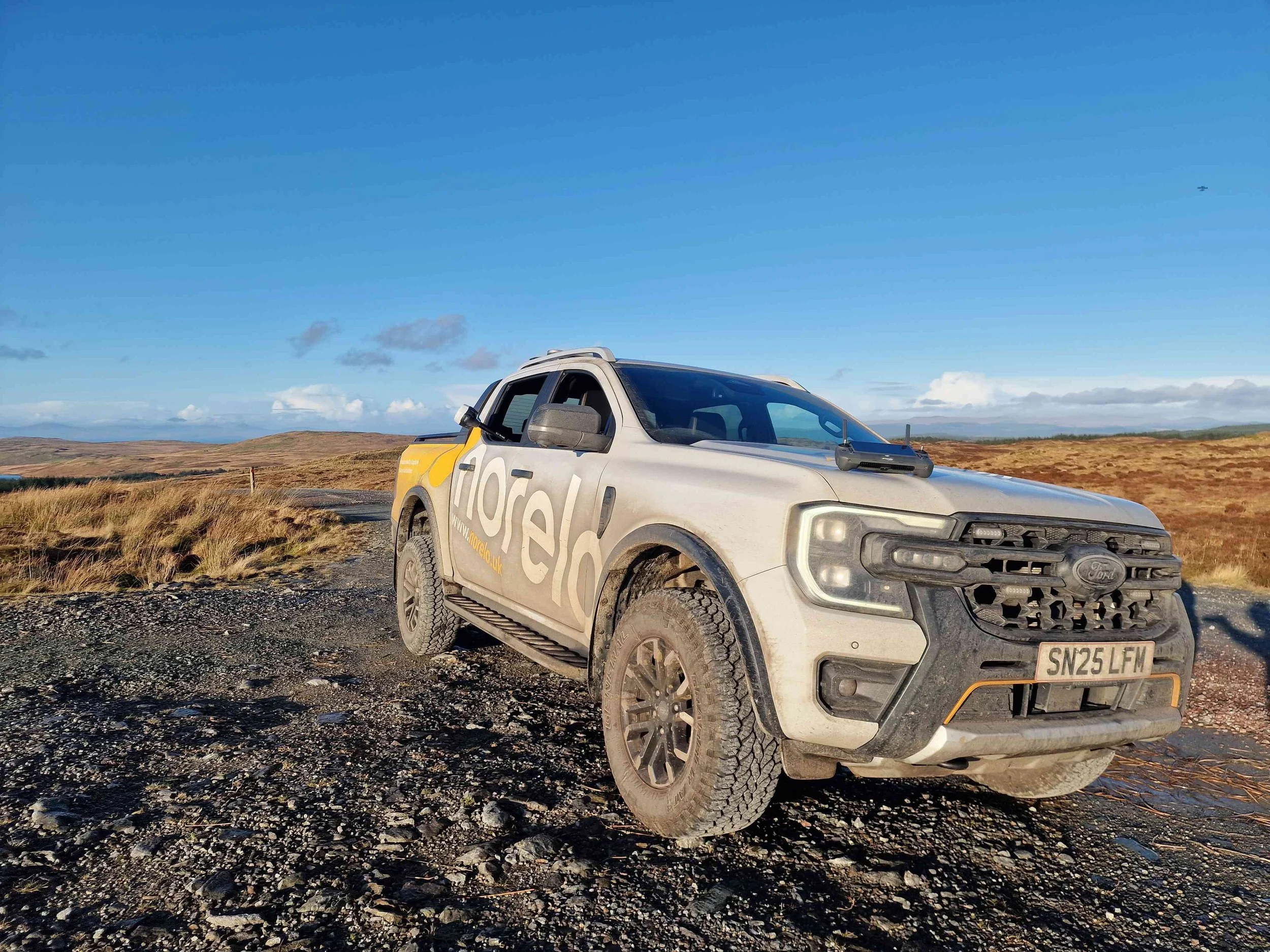
Drone Surveys
High-Resolution Imagery
Façade Inspection
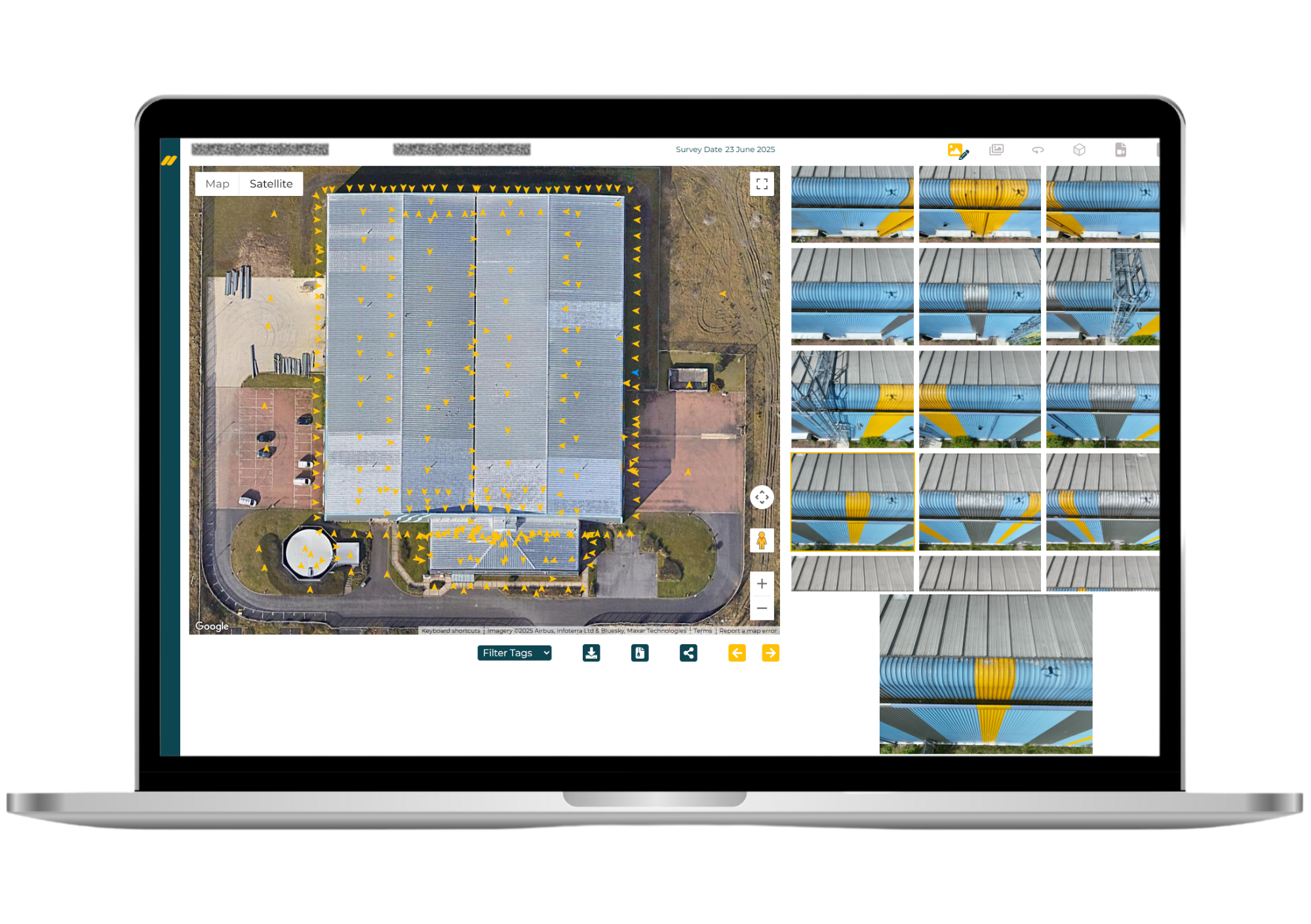
Roof Inspection
Window & Glazing Inspection
Roofline and Gutter Inspection
Mansafe Inspection
Bridge Deck & Underside Inspection
Corrosion and Rust Detection
Chimney Stack and Flue Survey
From £375
Drone surveys with Norelo start from £375 and go up to £575, with final pricing dependent on the site location and whether operations involve restricted or controlled airspace.
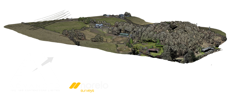
Photogrammetry Survey
As-Built Documentation
Heritage Preservation
Facade Preservation
Quantity and Volume Estimation
Virtual Inspection
Asset Management
Dispute Resolution
Integration with BIM
Pre-construction Planning
From £650
Photogrammetry surveys with Norelo typically range from £650 to £3,000 depending on the total gigapixels captured and the complexity of processing time, ensuring high‑resolution, accurate deliverables.
Topographical Survey
Topographical Drawing
Site Plans for Design and Planning
Volume Calculations
As-Built Surveys
Environmental & Landscaping
Orthophotos and Digital Terrain Models
Remote Monitoring
Integration with BIM
LiDAR Integration
From £650
Topographical surveys with Norelo typically range from £650 to £3,000, with costs varying based on the size of the site and the complexity of its features.
Why Choose Norelo Surveys Over Other Specialist Providers?
Unmatched Accuracy with Advanced Drone and Laser Technology
Norelo use the latest drone technology, LiDAR scanning, and terrestrial laser scanners to deliver accurate measured surveys, topographical drawings, and point cloud data. Norelo's precision ensures your project starts on a solid foundation.
Transparent, Competitive Pricing with No Hidden Costs
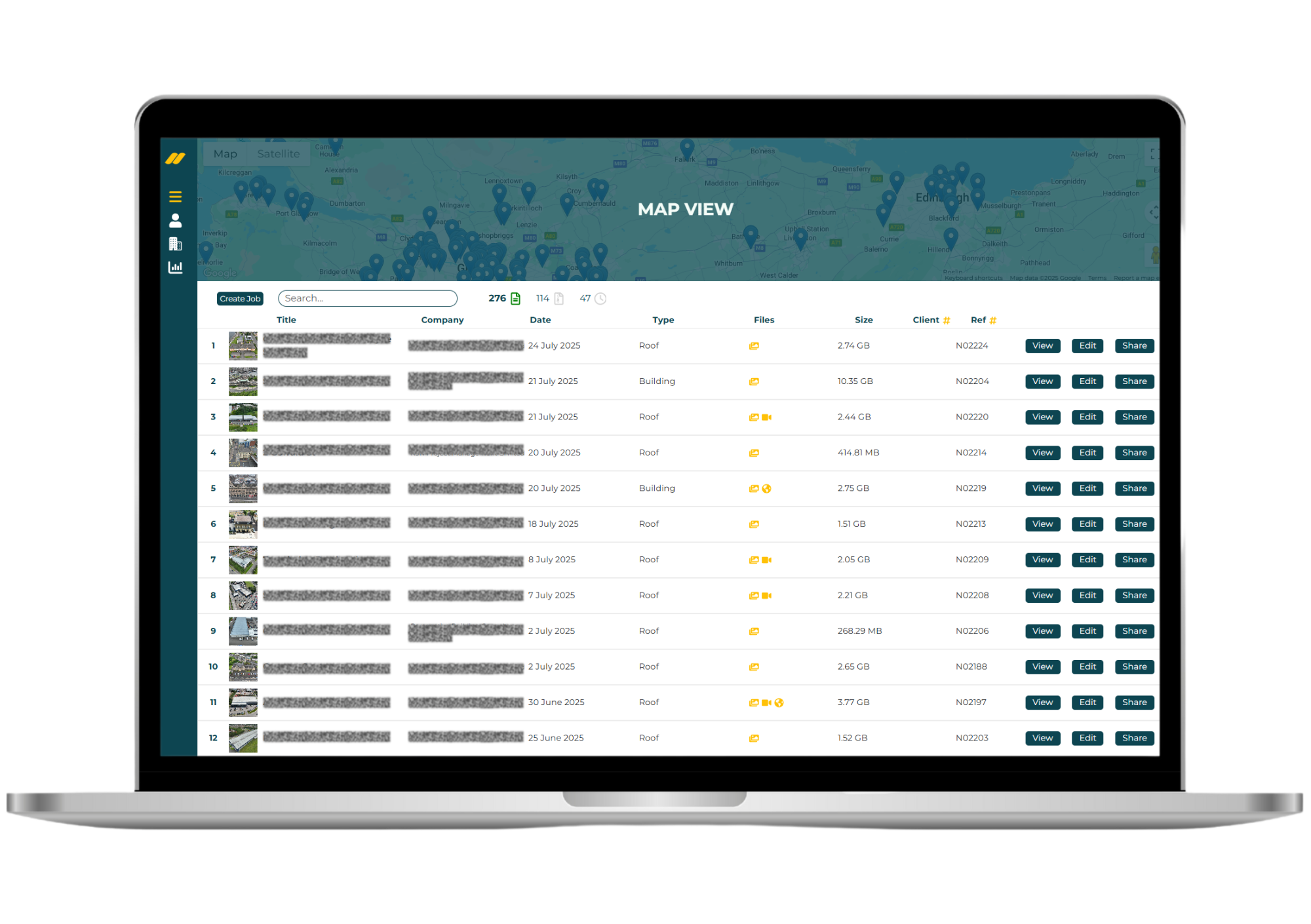
Norelo offer clear and competitive pricing for drone surveys, reality capture, CAD drawings, and 3D laser scanning. You’ll receive detailed quotations tailored to your requirements that are appealing, with reliable, professional service every time.
Quick Turnaround Times Without Compromising Quality
Norelo Ltd is committed to fast, efficient project delivery. Whether it's a full measured survey, drone roof inspection, or a complex geospatial mapping/LiDAR project, we meet deadlines while maintaining the highest quality standards.
START YOUR PROJECT
Email: Info@norelo.uk Call: 0141 353 9557
Fully Insured, Qualified, and Trusted Survey Professionals
Norelo's experienced team is CAA-certified for drone operations and qualified in advanced surveying techniques. Norelo operate with full public liability insurance, giving you complete peace of mind, for residential and commercial properties.
Our Valued Clients
KSNPM have been using Norelo for years for a wide range of data collection services to accompany our surveying and project management business. The photogrammetry and point cloud surveys are second to none which is why we continue to use them time and time again. Norelo cater to reactive project times and have a quick turn around on delivering the results. The team are incredibly professional and friendly, we highly recommend their services, and they offer top-tier CPD sessions for your workplace. 5 stars!
KSN Project Management
EXECUTIVE TEAM

We used Norelo for drone surveys as part of a large group of building surveys. The inspection period was very short and Norelo had no issues in meeting this challenging deadline. Magnus is readily contactable and easy to work with. The output quality is also very good.
James Taylor
ASSOCIATE DIRECTOR
The technological advancements in assisting contractors and surveyors with accurate data and working plans in the preconstruction phase has been incredible in the last few years. The level of detail and accuracy that help ensure issues and measured drawings can be provided from areas not normally accessible for a low cost before works commence is making a massive difference in our efficiency. Magnus and his team are the best at delivering these products to assist us in our operations.
Fraser Cattanach
MANAGING DIRECTOR
Our building consultancy regularly engages Norelo for large and/or tricky drone and photogrammetry surveys, which saves our design team survey and drawing time. Magnus and his team are very quick to respond to instructions, and also in submitting their deliverables. We would not hesitate to recommend Norelo to other clients or professionals.
Scott McPherson
ASSOCIATE DIRECTOR

Carried out a survey on the roof of our industrial site. Very reliable contractor, communicative and professional. Very happy with the end result and the usability of the asset inspection software.
Michael Carr
OPERATIONS MANAGER